No products
Southeastern Europe Old Maps with The Balkan Peninsula maps, Authentic old, antique, and rare maps of Atlases for sale.
See our Topographic Map Collection with sea charts of the Mediterranean Islands in our Mapandmaps online store.
Subcategories
Southeastern Europe Antique Prints. Original Old Topographical prints of the Balkan Peninsula with the present countries Albania Bosnia and Herzegovina Bulgaria Croatia Greece Kosovo Macedonia Montenegro Romania Serbia and Slovenia.
All Prints in antiquarian collectable condition.


Title: Imperii Turcici Europaei Terra in Primis Graecia.

17th century antique map of the Balkans shows Wallachia, Servia, Bulgaria, Moldavie, Romania and Constantinople.

Old woodcut map of the Istrian peninsula shared by three countries: Croatia, Slovenia, and Italy.


Title: Pannoniae et Illyrici Veteris Tabvla.


Early antique woodcut of Greece with sea monsters and Sailing ship.
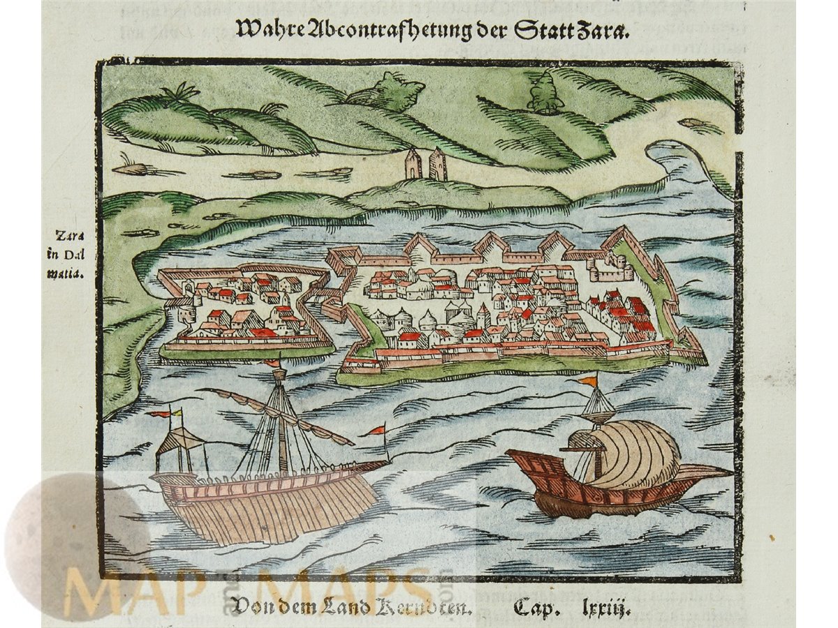
Croatie Sadar, Early woodcut map, Zara by Sebastian Munster.

Title: Graecia Vetus Ex Schoedis Sansonianis Desumpta...

Title: La Turquie en Europa Sur les obsevations de L'Acadamie des Scienses de Paris.

Title: Sclavonia Croatia Bosnia cum Dalmatia parte.

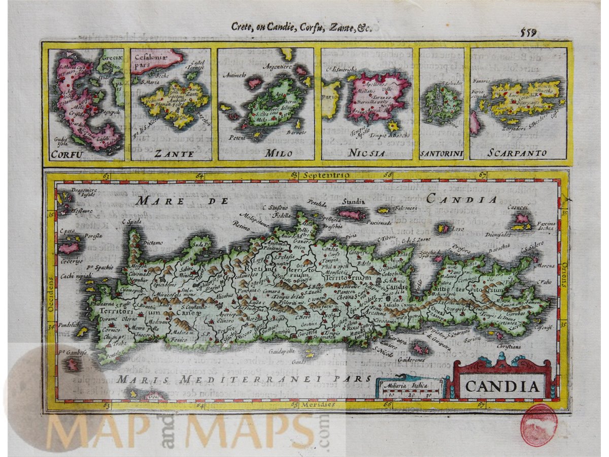
Greece Lot of 2 antique maps. Milos Greece - Skyros Greece. 1776 maps

Artist: Jacques Chiquet (circa 1673-1721) was a French cartographer.
Beautiful and detailed historical Mercator map of northeastern Italy, Slovenia and Croatia.
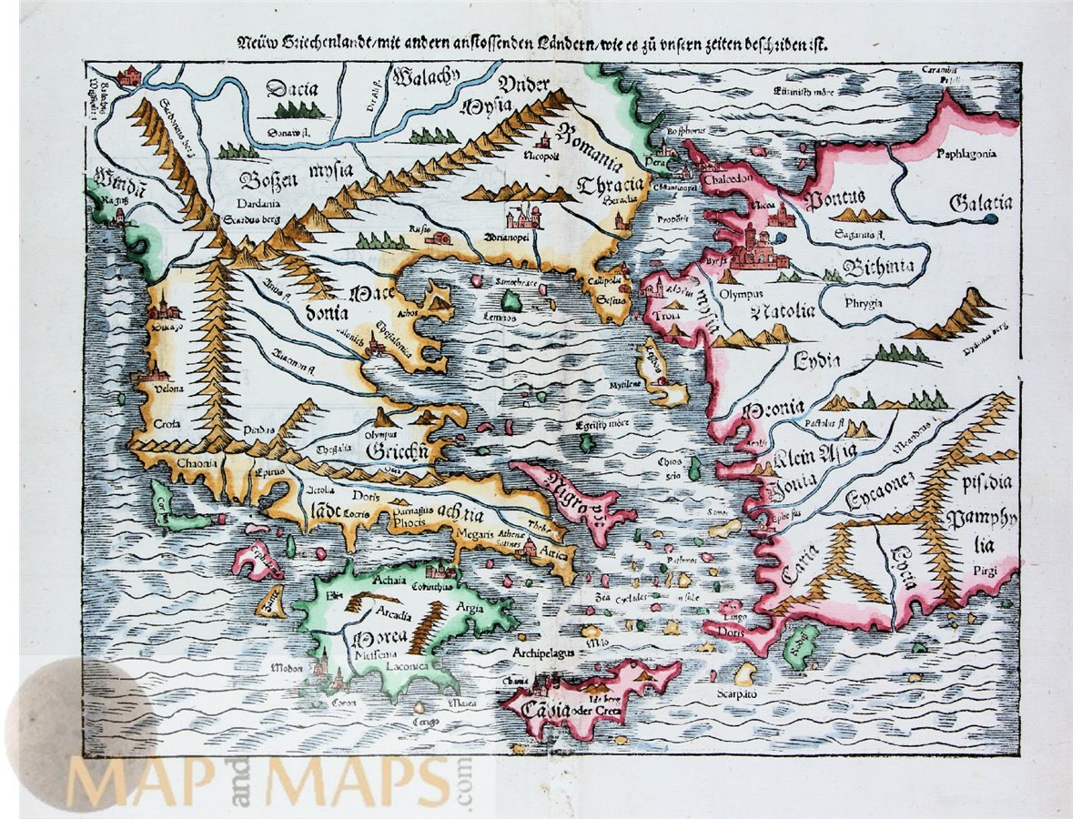
The 1574 map of Greece is a particularly fine example of Münster's cartographic work.

This collection of four historical antique maps of Greece offers a fascinating glimpse into the country's rich history and geography.

Antique historical map of Italy, Sicily, Greece and the Mediterranean, showing the egendary voyage of Aeneas, a Trojan hero who escapes the fall of Troy.