No products
South America Antique Maps, Fine Charts of the South American Countries All antique maps are guaranteed authentic and in great antiquarian condition, made by the best cartographers (Map-Makers) who mapped the World out the history of voyages of discoveries.
Subcategories
South America Antique Old Prints, all Fine & Rare Original Old Prints, authentic historical topography created by the greatest Print-Makers who engraved the Views out the history of voyages of discovery.

Cayenne Island old antique map of South America at the mouth of the Cayenne River.

Fine detailed antique map of the South America countries.

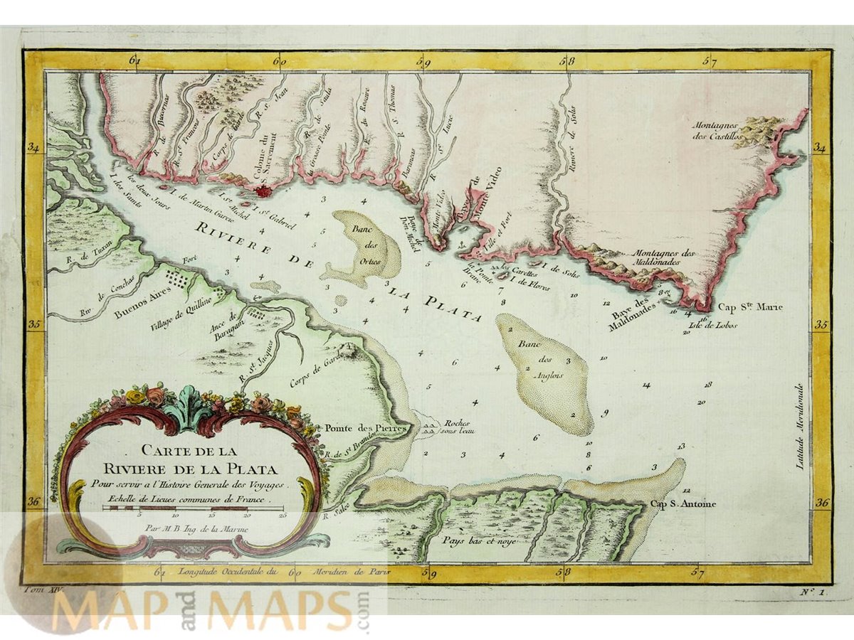
Title: Plan de la Baye de Zisapata a la coste de Terre Ferme.


Northern South America witht the Northeastern part of Venezuela, and the Caribbean islands.

Captain James Cook Voyages South America.

Fortification Cayenne in French Guiana, South America.

Antique Old map Suriname and British French Guyana.

Title: Carte du Brasil, Prem. Partie.Depuis la Riviere des Amazones jusqua la Baye de Tous les Saints.

Antique map of British Guayna South America with original outline hand coloring, decorative border.

Title: Venezuela, New Granada, Equador, and the Guayanas.


Title: Plan de la Ville et Cite de St. Francois de Quito.

Title : Carte de L’Entrée de la Riviere de Corentyn Sur ce que les Anglois et les Hollandois en ont publiée.

Title : Carte des entrées des Rivieres de Demerary et d’Essequebe suivant les plans des Hollandais.
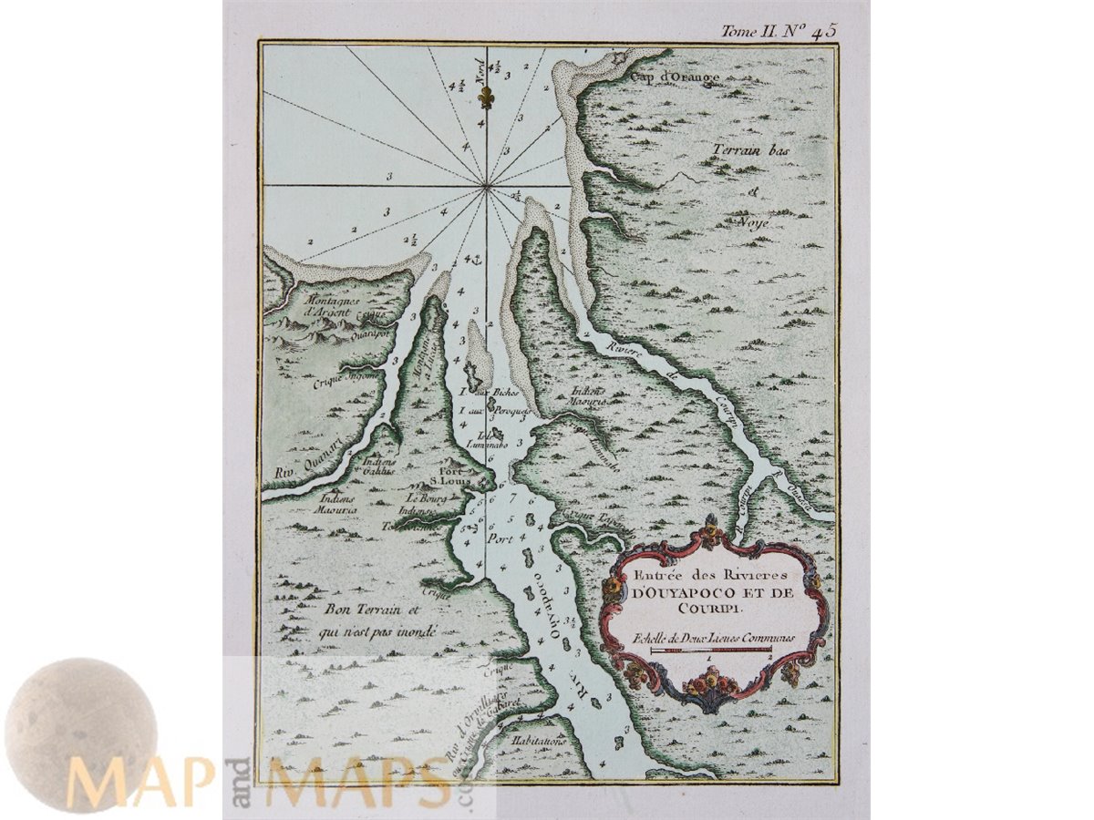
Title : Entrée des Rivieres D’Ouyapoco et de Couripi.

Antique ground plan of Paita Peru, Paita was the Spanish capital of the northwestern Peruvian coast.


Title: Plan de la Baye du Bon Succès dans le Détroit de la Maire; Carte de la partie S.E. de la Terre de Feu comprenant le Détroit de la Maire et une partie de la Terre des Etats.

Title: Carta Geografica Della America Meridionale.


Peru, including Lima with the ancient places.