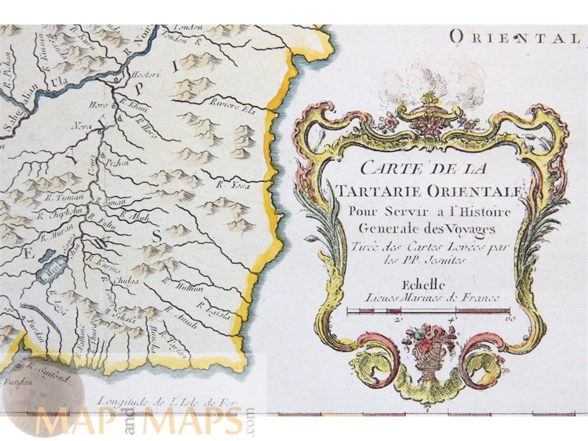
China Tartary Old map Östlichen East Tartarey Old map Russia China Bellin 1764.
Title: Zu der allgemeinen Reisebeschreibung aus den Karte der Jesuite.
Description: Eastern Tartary China Old antique map copperplate engraved and taken from Prevost's L`Histoire Generale des Voyages cartographer Bellin. This map covers the Amur River, forming the border between the Russian Far East and Northeastern China (Inner Manchuria) and the now Russian island Sakhalin.
Cartographer: Jacques Nicolas Bellin (1703 – 21 March 1772) (Royal Hydrographer, engineer of the French Navy and member of the Royal Society)
From: Antoine-François Prevost's " L`Histoire Generale des Voyages" Published by Pierre de Hondt, The Hague between 1747 -1780.
16th -17th -18th-19th Century maps & atlases & prints. ORIGINAL ANTIQUE ENGRAVING. Guaranteed Absolutely Original authentic Maps and Prints. A Certificate of Authenticity ( COA ) will be supplied on request. We ship our antique items across the world.
Sheet app.: 37 x 25 cm. 14.5 x 9.5 inches. Image app.: 31 x 21 cm. 12.25 x 8.25 inches. Condition: Very good condition, restored right lower corner, folds as published.