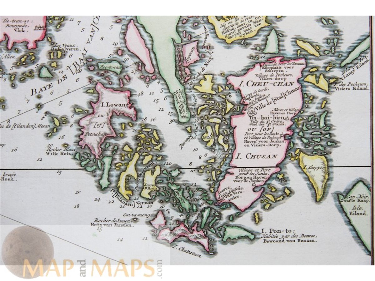
China maps. Cheu-Chan - Zhejiang,(Che-Kiang Bellin 1754
Title: Carte de L’Isle de Cheu-Chan – Kaart van’t eiland Cheu-Chan…
Description: China maps, old antique map of Zhejiang (Che-Kiang) China by the cartographer Nicolas Bellin. The map is an original antique map copperplate engraving by Jakob van der Schley and published in Antonine de Prevost d' Exile's Histoire generale des voyages 1754. Cartographer Jacques Nicolas Bellin (1703 – 21 March 1772)
Cartographer Nicolas Bellin was born in Paris. He was hydrographer of France's hydrographic office, member of the Académie de Marine and of the Royal Society of London. Over a 50 year career, he produced a large number of maps of particular interest to the Ministère de la Marine.
Published in Antonine de Prevost d' Exile's Histoire generale des voyages. Engraved by Jakob van der Schley aka Jakob van Schley (26 July 1715 Amsterdam - 12 February 1779 Amsterdam) was a Dutch draughtsman and engraver. He studied under Bernard Picart (1673-1733)
16th -17th -18th-19th Century maps & atlases & prints. We sell guaranteed Absolutely Original authentic Maps and Prints. A Certificate of Authenticity ( COA ) will be supplied on request. We ship internationally.
Size: Sheet app.: 36 x 25 cm. 14.25 x 10 inches. Image app.: 31.5 x 21 cm. 12.5 x 8.25 inches. Condition: Beautiful historical hand-colored antique map of China, no flaws, no water spots, perfect condition.