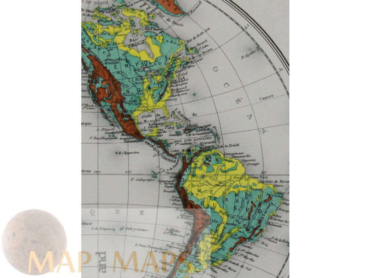
titled "Mappemonde Hypsométrique," (hypsometric world map.)
Antique double-hemisphere world map that shows the elevation of landmasses above sea level. The map is hand-colored and was created by J. Migeon, a French cartographer and publisher who was active in the mid-19th century.
The map was published in 1864 and is considered to be an important historical document. The "Mappemonde Hypsométrique" map is one of the earliest hypsometric maps of the world. It was created using a new technique called "hill shading," which allowed cartographers to represent the elevation of landmasses in a more realistic way than ever before. The map is also notable for its use of bright hand coloring, which gives it a striking appearance.
Signed by I. Smith and Ercit A. Bizet, who were likely the engravers responsible for creating the map from Migeon's design. The map is considered to be an important example of early hypsometric mapping and is a valuable resource for historians and geographers.
Size: Sheet app.: 51 x 36.5 cm. 20 x 14.5 inches. Image app.: 41 x 20.5 cm. 16 x 8.25 inches. Condition: Excellent.